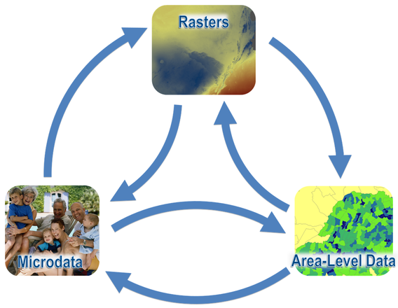
TerraPop makes existing collections of environmental and population data more valuable by making them interoperable over time, space, and topic, and by providing data access tools to facilitate data searching and discovery. The extract builder allows users to easily find data of interest and obtain customized integrated datasets in formats they are familiar with, even if the source data are from outside the user's primary domain.
Location-Based Integration
TerraPop leverages geographic properties to integrate information from datasets in multiple data structures to generate customized, integrated datasets for users. Users can mix and match variables originating in raster, area-level, and/or microdata datasets, and obtain output in whichever of the three structures best meets their needs. The TerraPop system uses information about the location of each record in the original data to attach contextual information, generate spatial summaries, or assign values to points, depending on the transformation requested.

Users can obtain data extracts structured as:
- Microdata with attached contextual variables describing the social and environmental properties of the area in which the individual or household is located.
- Area-level data describing the population and environmental characteristics of sets of places (such as administrative units). Area-level extracts may include information summarized from raster data or tabulated from microdata.
- Rasters containing data about how population and environmental characteristics vary across space. Raster extracts may include rasters derived from area-level data or tabulated microdata.
